Forecast
Bogota
Local time--:--
America/BogotaWeather Forecast
Bogota, ColombiaOpen-Meteo forecast.
Bogota city overview
Bogota is Colombia's high-altitude capital, a city of museums, mountain views and distinct neighborhoods spread across a broad plateau. Begin in La Candelaria for Plaza de Bolivar, the Gold Museum and Botero Museum, then ride up Monserrate when the weather is clear. El Dorado airport is the main gateway, with traffic making hotel location especially important.
Worth seeing
Gold Museum
The Gold Museum is Bogota's essential museum, with extraordinary pre-Hispanic goldwork and clear context for Colombia's Indigenous cultures.
View on map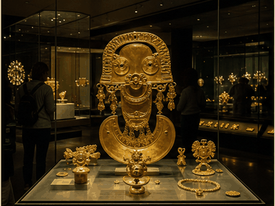
Monserrate
Monserrate rises above the city with sweeping views, reached by funicular, cable car or a steep pilgrimage path.
View on map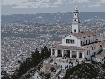
La Candelaria
La Candelaria is a named Bogota landmark that helps structure a real visit, adding orientation, local context and a clear route anchor.
View on map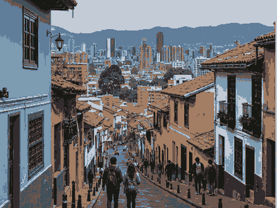
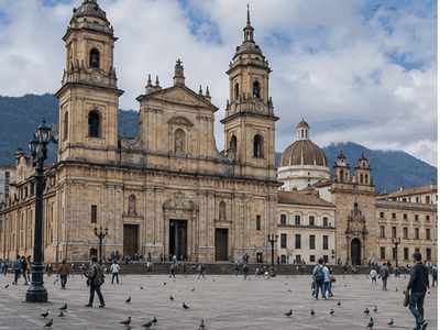
Plaza de Bolivar
Plaza de Bolivar is Bogota's civic centre, surrounded by the cathedral, Congress, Palace of Justice and city hall.
View on map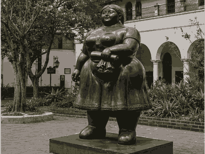
Botero Museum
Botero Museum is a key Bogota culture stop, useful for understanding local history, collections and rainy-day planning near the main sightseeing route.
View on map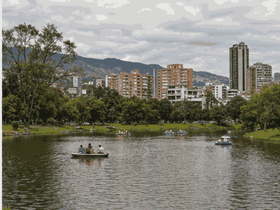
Simon Bolivar Metropolitan Park
Simon Bolivar Metropolitan Park is Bogota's major urban park, useful for concerts, walking and a break from traffic.
View on mapStay overview
Pick La Candelaria for museums and short sightseeing stays, Chapinero for restaurants and central movement, Zona Rosa for nightlife and shopping, Usaquen for quieter dining, or Teusaquillo for parks, embassies and longer business stays.
Hotels & areas
Bogota hotel choice should account for altitude, traffic and evening plans. La Candelaria is best by day, Chapinero and Zona Rosa work better at night, Usaquen is calmer, and Teusaquillo suits practical longer stays.
La Candelaria
La Candelaria is best for museums, colonial streets and first-time sightseeing, though evenings need more caution and taxi use.
Best for: history, museums, short staysSee hotel optionsChapinero
Chapinero is central and lively, with restaurants, bars, universities and good access north or south by taxi.
Best for: restaurants, nightlife, central accessSee hotel optionsZona Rosa
Zona Rosa and Zona T suit travelers wanting nightlife, shopping, safer evening movement and upscale hotel options.
Best for: nightlife, shopping, upscale staysSee hotel optionsUsaquen
Usaquen is calmer and village-like, with restaurants and a popular Sunday market in the north of the city.
Best for: quiet stays, dining, Sunday marketSee hotel optionsTeusaquillo
Teusaquillo works for business, universities, embassies and access to parks, with a more residential feel.
Best for: business, parks, longer staysSee hotel optionsFlights & airports
El Dorado International Airport (BOG) arrival plan
- El Dorado International Airport (BOG)About 13 km from the centre
Compare airport access against hotel location, arrival time, rental car pickup, late flights and onward driving before choosing the first night base.
- Vanguardia Airport (VVC)About 71 km from the centre
Compare airport access against hotel location, arrival time, rental car pickup, late flights and onward driving before choosing the first night base.
Rental cars
Bogota day-trip car use
Do not rent a car for central Bogota; traffic and parking make taxis, rideshare and organized day trips easier.
Compare rental carsTravel tips
Altitude
Bogota sits high, so take the first day slowly and hydrate before climbing Monserrate or walking long routes.
Best base
Use Chapinero or Zona Rosa if restaurants and safer evenings matter more than waking up beside the museums.
Traffic
Keep the Bogota plan compact: group nearby sights together and leave enough time for transfers, meals and weather changes.
Day trips
Zipaquira's Salt Cathedral is the simplest famous day trip, while Villa de Leyva is better as an overnight.
Nearby ideas
Heritage · about 1 h 15 min · bus from Portal del Norte, or the tourist train at weekends
Zipaquirá Salt Cathedral
A church carved 180 metres down inside a working salt mine, lit in blue and violet.
View on mapNature · about 1 h 15 min · bus from Portal del Norte towards Sesquilé
Guatavita
The crater lake behind the El Dorado legend, where Muisca chiefs were gilded and submerged.
View on mapMountain · about 40 min · car east over the Cerros Orientales
La Calera and the eastern hills
A ridge road climbing out of the city to páramo grassland and a view back over the whole savanna.
View on mapCity history
Fourteen years later in 1564, the Spanish Crown designated the first Royal Audiencia chairman, Andrés Díaz Venero de Leyva.
After 1717 Santafé became the capital of the Viceroyalty of New Granada.
After the establishment of a junta in Cartagena de Indias on 22 May 1810, and in many other cities throughout the Viceroyalty, the Junta de Santa Fe was established on 20 July 1810, in.
Between 1819 and 1849, there were no fundamental structural changes from the colonial period.
The Central University was the first State school, precursor of the current National University, founded in 1867 and domiciled in Bogotá. Regeneration President Rafael Núñez declared the end of Federalism, and in 1886 the.
In 1910, the Industrial Exposition of the Century took place at Park of Independence.
In 1948 liberal leader Jorge Eliécer Gaitán was assassinated, and subsequent riots in an event called El Bogotazo resulted in Bogotá's downtown being virtually destroyed.
The administrations of mayors Andrés Pastrana (1988–90) and Jaime Castro (1992–94), in addition to the first of Antanas Mockus (1995–97), formulated proposals to solve the problem of public transport, with limited results.
The TransMilenio system of articulated buses opened its first phase in 2000 and has since grown to 12 lines.
By the mid-19th century, a series of fundamental reforms were enacted, some of the most important being slavery abolition and religious, teaching, print and speech industry and trade freedom, among others.
The violence sparked civil conflict, La Violencia, that lasted ten years. Twenty-first century The city began the 21st century with important changes in its urban space and public transport, looking to plan demographic and.
Bogotá, then called Santa Fe, later became the capital of the later Viceroyalty of New Granada. Spanish colonization The city mayor and the chapter formed by two councilmen, assisted by the constable and the.
Importance grew when the diocese was established. Nineteenth century Political unease over the Spanish monarchy and the rights of citizens born in the Americas had been felt throughout the Spanish colonies in America, and.
Plaza de Bolívar and surroundings lodged hat stores, at Calle del Comercio –current Carrera Seventh– and Calle Florián –now Carrera Eight– luxurious stores selling imported products opened their doors; at Pasaje Hernández, tailor's shops.