Forecast
Santiago
Local time--:--
America/SantiagoWeather Forecast
Santiago, ChileOpen-Meteo forecast.
Santiago city overview
Santiago sits between the Andes and Chile's central valley, mixing government squares, wine-country access and a fast-growing restaurant scene. Start at Plaza de Armas, ride up Cerro San Cristobal for scale, then spend an evening in Barrio Lastarria or Bellavista. Arturo Merino Benitez airport is the main gateway, with easy onward routes toward Valparaiso and the Maipo Valley.
Worth seeing
Plaza de Armas
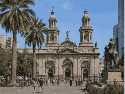
Plaza de Armas is a named Santiago landmark that helps structure a real visit, adding orientation, local context and a clear route anchor.
View on map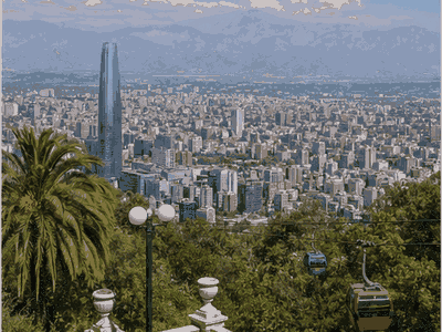
Cerro San Cristobal
Cerro San Cristobal gives the best sense of Santiago's scale, with city views backed by the Andes on clear days.
View on map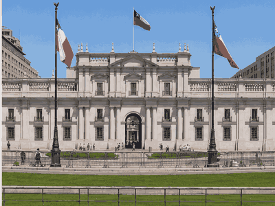
La Moneda Palace
La Moneda Palace anchors the historic and ceremonial side of Santiago, making it a practical stop for architecture, local memory and orientation.
View on map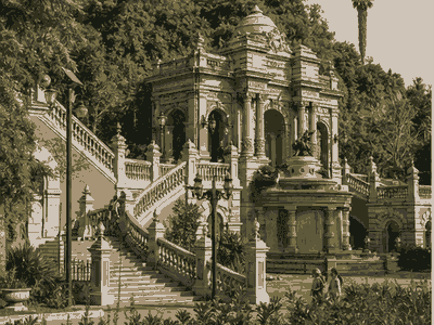
Sky Costanera
Sky Costanera is a named Santiago landmark that helps structure a real visit, adding orientation, local context and a clear route anchor.
View on map
Barrio Lastarria
Barrio Lastarria is a named Santiago landmark that helps structure a real visit, adding orientation, local context and a clear route anchor.
View on map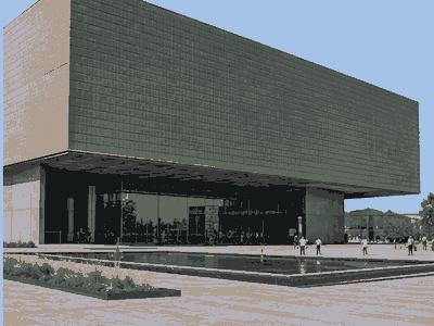
Museo Chileno de Arte Precolombino
Museo Chileno de Arte Precolombino is a named Santiago landmark that helps structure a real visit, adding orientation, local context and a clear route anchor.
View on mapStay overview
Lastarria is the easiest first Santiago base for culture and restaurants, while Providencia is the practical metro-connected choice. Bellavista suits nightlife, Las Condes works for business and Andes access, and Centro is best for daytime history walks.
Hotels & areas
Santiago hotel choice depends on the trip rhythm: Lastarria and Providencia balance sightseeing and evenings, Bellavista is social, Las Condes is business-oriented and polished, and Centro is convenient for civic sights but less relaxed late.
Lastarria
Lastarria is the best first base for cafes, museums, walkable streets and easy access to downtown sights.
Best for: first visits, culture, restaurantsSee hotel optionsProvidencia
Providencia is practical and well connected, with metro stops, hotels, shops and safer evening movement than the historic core.
Best for: metro access, business, valueSee hotel optionsBellavista
Bellavista is nightlife-focused and close to Cerro San Cristobal, best for social stays rather than quiet nights.
Best for: nightlife, restaurants, Cerro San CristobalSee hotel optionsLas Condes
Las Condes suits business travelers and upscale hotels, with malls, offices and easier access toward the Andes.
Best for: business, upscale hotels, Andes accessSee hotel optionsCentro
Centro is closest to civic sights and museums, but evenings are quieter and require more street awareness.
Best for: history, museums, daytime walkingSee hotel optionsFlights & airports
Comodoro Arturo Merino Benítez International Airport (SCL) arrival plan
- Comodoro Arturo Merino Benítez International Airport (SCL)About 15 km from the centre
Compare airport access against hotel location, arrival time, rental car pickup, late flights and onward driving before choosing the first night base.
Rental cars
Santiago day-trip car use
Skip a rental car inside Santiago; rent only for wineries, ski areas, Cajon del Maipo or longer road trips.
Compare rental carsTravel tips
Best base
Choose Lastarria or Providencia for a first stay because both balance restaurants, metro access and major sights.
Air quality
Winter smog can hide mountain views, so plan viewpoints flexibly and check visibility before going up Cerro San Cristobal.
Metro use
Use the metro for cross-city movement, but watch bags closely at busy stations and during rush hours.
Day trips
Valparaiso, Maipo Valley and Cajon del Maipo each need a different kind of day, so avoid combining them.
Nearby ideas
Town · about 1 h 15 min · coach from Terminal Alameda
Valparaíso
Painted houses on forty-two hills, linked by Victorian funiculars still in service.
View on mapMountain · about 1 h · car or colectivo south-east on Route G-25
Cajón del Maipo
An Andean canyon with hot springs at Baños Morales and the El Yeso reservoir above.
View on mapWine · about 1 h · car west on Route 68 towards Valparaíso
Casablanca Valley
Cool coastal vineyards making sauvignon blanc and chardonnay, with cellar doors on the highway.
View on mapUpcoming events
City history
Santiago was left vulnerable, and a coalition of Mapuche and Picunche tribes led by chief Michimalonco destroyed the city on 11 September 1541, despite the efforts of a Spanish garrison of 55 soldiers defending.
The city was gradually rebuilt, with the newly established city of Concepción gaining political prominence as the Royal Audiencia of Chile was established there in 1565.
During the 16th and 17th centuries, the growth of the city was hindered by a series of disasters including an earthquake, a smallpox epidemic in 1575, the Mapocho River floods in 1590, 1608, and.
However, the ongoing threat of the Arauco War and frequent earthquakes delayed the establishment of the Royal Court in Santiago until 1607, which solidified the city's status as the capital.
In 1780, Governor Agustín de Jáuregui hired the Italian architect Joaquín Toesca, who designed several important buildings, including the cathedral's façade, the Palacio de La Moneda, the San Carlos Canal, and the completion of.
The O'Higgins government also opened the road to Valparaíso in 1791, connecting the capital with the country's main port. Capital of the Republic On September 18, 1810, the First Government Junta was proclaimed in.
In 1851, the first telegraph system connecting the capital to the Port of Valparaíso was inaugurated.
Modernity also spread in the city, with the introduction of the first theaters, the expansion of the telephone network, and the opening of Los Cerrillos Airport in 1928, among other advancements.
The 1962 World Cup provided a new impetus for city improvement efforts, and in 1966, the Santiago Metropolitan Park was established on Cerro San Cristóbal.
In 1967, the new Pudahuel International Airport was opened, and after years of discussion, construction of the Santiago Metro began in 1969.
The first phase of the Metro, which ran beneath the western section of Alameda, was opened in 1975 and soon became one of the most prestigious buildings in the city.
On 27 February 2010, a powerful earthquake hit the capital city of Santiago, causing damage to some older buildings and rendering some modern structures uninhabitable.
This new peripheral development marked the end of the previous checkerboard structure that had dominated the city center. 19th century During the Republican era, several institutions were founded, including the University of Chile, the.
The Incas established a settlement of mitimas in the valley, located in the center of present-day Santiago, with fortifications such as Huaca de Chena and the El Plomo hill sanctuary.