Forecast
Sao Paulo
Local time--:--
America/Sao_PauloWeather Forecast
Sao Paulo, BrazilOpen-Meteo forecast.
Sao Paulo city overview
Sao Paulo is Brazil's giant cultural and business capital, a city of food, museums, immigrant districts and nonstop events rather than postcard viewpoints. Start on Paulista Avenue, spend time in Ibirapuera Park, and visit the Sao Paulo Museum of Art before eating through Liberdade or Pinheiros. Guarulhos is the main international airport, while Congonhas is useful for domestic flights.
Worth seeing
Paulista Avenue
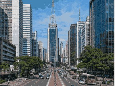
Paulista Avenue is a named Sao Paulo landmark that helps structure a real visit, adding orientation, local context and a clear route anchor.
View on map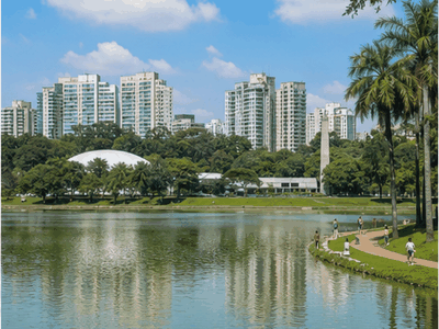
Ibirapuera Park
Ibirapuera Park adds outdoor time to a Sao Paulo stay, with open space, views or waterfront breathing room between denser city sights.
View on map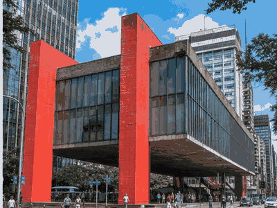
Sao Paulo Museum of Art
The Sao Paulo Museum of Art, or MASP, is an architectural landmark with one of Latin America's key art collections.
View on map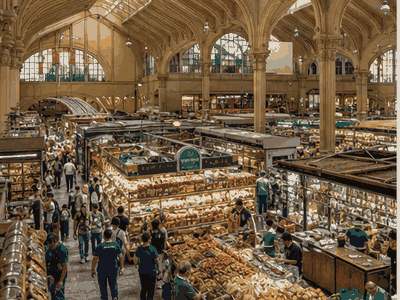
Pinacoteca
Pinacoteca is a named Sao Paulo landmark that helps structure a real visit, adding orientation, local context and a clear route anchor.
View on map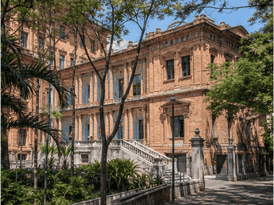
Mercado Municipal
Mercado Municipal is a named Sao Paulo landmark that helps structure a real visit, adding orientation, local context and a clear route anchor.
View on map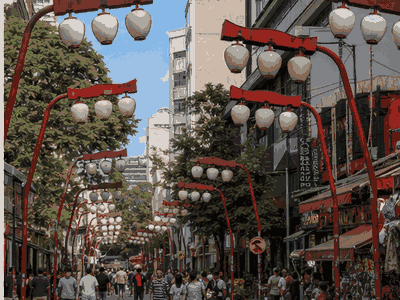
Liberdade
Liberdade is a named Sao Paulo landmark that helps structure a real visit, adding orientation, local context and a clear route anchor.
View on mapStay overview
Use Jardins for the safest first Sao Paulo base, Bela Vista for Paulista access and value, Pinheiros or Vila Madalena for restaurants and nightlife, and Itaim Bibi when business meetings around Faria Lima shape the trip.
Hotels & areas
Sao Paulo hotel choice is about scale: stay near the districts you will repeat. Jardins and Bela Vista suit first visits, Pinheiros and Vila Madalena suit evenings, and Itaim Bibi is practical for business-heavy schedules.
Jardins
Jardins is the safest all-round first base, close to Paulista Avenue, restaurants, shops and easy taxi or metro access.
Best for: first visits, dining, safetySee hotel optionsBela Vista
Bela Vista works for Paulista Avenue, theatres, Italian restaurants and metro access at generally better prices than Jardins.
Best for: Paulista, theatres, valueSee hotel optionsPinheiros
Pinheiros is strong for restaurants, bars, galleries and nightlife, with good metro links and a more local feel.
Best for: nightlife, restaurants, local staysSee hotel optionsVila Madalena
Vila Madalena is a hilly creative district known for bars, street art and guesthouses, best for social stays.
Best for: bars, street art, weekendsSee hotel optionsItaim Bibi
Itaim Bibi suits business travelers, upscale restaurants and quick car access to Faria Lima and Vila Olimpia offices.
Best for: business, dining, upscale staysSee hotel optionsFlights & airports
Congonhas–Deputado Freitas Nobre Airport (CGH) arrival plan
- Congonhas–Deputado Freitas Nobre Airport (CGH)About 9 km from the centre
Compare airport access against hotel location, arrival time, rental car pickup, late flights and onward driving before choosing the first night base.
- São Paulo/Guarulhos–Governor André Franco Montoro International Airport (GRU)About 21 km from the centre
Compare airport access against hotel location, arrival time, rental car pickup, late flights and onward driving before choosing the first night base.
- Viracopos International Airport (VCP)About 79 km from the centre
Compare airport access against hotel location, arrival time, rental car pickup, late flights and onward driving before choosing the first night base.
Rental cars
Sao Paulo day-trip car use
Avoid renting a car for central Sao Paulo; metro, taxis and rideshare are easier than parking and traffic.
Compare rental carsTravel tips
Best base
Choose Jardins or Bela Vista for a first stay because Paulista Avenue, museums and metro links stay close.
Traffic planning
Build generous buffers for airport transfers and cross-town meetings; distance on the map rarely predicts Sao Paulo travel time.
Food focus
Reserve key restaurants ahead, especially in Jardins, Pinheiros and Itaim Bibi on weekends or event nights.
Safety basics
Use normal big-city caution with phones and bags, especially downtown and around crowded transit or nightlife exits.
Nearby ideas
Craft · about 50 min · bus from Terminal Rodoviário Barra Funda
Embu das Artes
A colonial village given over to furniture makers and a crafts fair that fills the streets at weekends.
View on mapNature · about 50 min · car or bus north to Horto Florestal
Serra da Cantareira
One of the largest urban rainforests on earth, with trails, waterfalls and howler monkeys.
View on mapHeritage · about 1 h 15 min · car or train to Rio Grande da Serra, then local bus
Paranapiacaba
A British-built railway village in the cloud forest, preserved with its funicular workshops.
View on mapCity history
The Portuguese village of São Paulo dos Campos de Piratininga was marked by the founding of the Colégio de São Paulo de Piratininga on 25 January 1554.
Father José de Anchieta wrote this account in a letter to the Society of Jesus: The settlement of the region's Courtyard of the College began in 1560.
The bandeirantes eventually became politically powerful as a group, and forced the expulsion of the Jesuits from the city of São Paulo in 1640.
The new capital was established on 23 April 1683, with public celebrations. The Bandeirantes In the 17th century, São Paulo was one of the poorest regions of the Portuguese colony.
The Captaincy of São Paulo and Minas de Ouro (see Captaincies of Brazil) was created on 3 November 1709, when the Portuguese crown purchased the Captaincies of São Paulo and Santo Amaro from the.
In 1827, a law school was founded at the Convent of São Francisco, today part of the University of São Paulo.
From 1869 onward, São Paulo was connected to the port of Santos by the Estrada de Ferro Santos-Jundiaí (Santos-Jundiaí Railroad), nicknamed The Lady.
The region's first industries also began to emerge, providing jobs to the newcomers, especially those who had to learn Portuguese. Old Republican period By the time Brazil became a republic on 15 November 1889.
In 1934, with the reunion of some faculties created in the 19th century, the University of São Paulo (USP) was founded, today the largest in Brazil.
In 1947, São Paulo gained its first paved highway: the Via Anchieta (built on the old route of José de Anchieta), connecting the capital to the coast of São Paulo.
At the end of the 20th century and beginning of the 21st century, São Paulo became the main financial center in South America and one of the most populous cities in the world.
The expansion of coffee production was a major factor in the growth of São Paulo, as it became the region's chief export crop and yielded good revenue.
São Paulo became the point of convergence of all railroads from the interior of the state.
After abolition, and following governmental stimulus towards the increase of immigration, the province began to receive a large number of immigrants, largely Italians, Japanese and Portuguese peasants, many of whom settled in the capital.